The Melbourne Map Illustrator / Cartography - Melbourne, Australia
Melinda Clarke
Can you tell us briefly of the history of the 1st Melbourne Map?
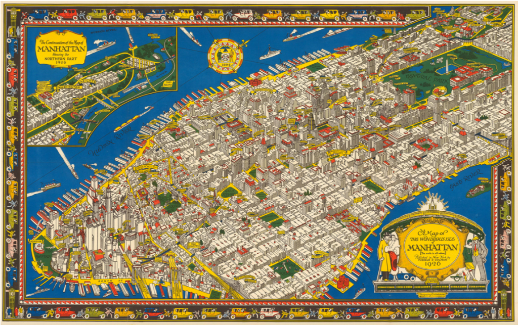
Original: In my mid 20’s I headed off to explore the world and spent a couple of years backpacking around Europe and the USA. Along the way I collected some fabulous illustrated maps and upon my return to Melbourne I searched for one of Melbourne. The only map I could find was a beautiful illustration by A.C. Cooke, later engraved by Samuel Calvert for inclusion in the Illustrated Australian News in 1880.
I put a business plan together based on the idea of producing a modern illustrated map of Melbourne and searched for an artist to collaborate with. As serendipity would have it I met Deborah Young through a friend and we worked at nights and weekends from a converted garage at the back of my mother’s house. Over 7,500 research photos were taken and developed, many from a hot air balloon. It took us over 4 years to complete the research and illustration and eventually I took out a $50,000 loan with the ANZ bank at 22.5% interest so Deborah could leave her full time job and complete the drawing.
Once the line drawing was finished it was printed as a limited edition print of 1,000 on to archival rag paper and we went about selling the prints at $250 each.
Coloured
A year later two other artists joined the project (Heather Potter & Mark Jackson) who made some updates to the original drawing and a limited edition of 25 was screen printed by Larry Rawlings. One of those prints was then meticulously hand coloured (watercolour) referring to the original research photos. It took 8 months to complete this stage.
I printed and marketed a full colour poster in several sizes, a jigsaw puzzle, gift cards and post cards.
It was an extraordinarily popular image, made even more intriguing as people poured over the “Can You Find?” list and tried to find all the buildings, transport, people and events included in the illustration.
The whole team had such a great experience creating The Melbourne Map and I think this transferred on to the illustration and to the end user. The map appealed to all ages and adorned the walls of homes and offices here and abroad.
What lead you to do a second Melbourne Map?
It was a multitude of things the seed was set when I made a decision to clear out the back shed which housed all the photos and memorabilia I had stored for 25 years. Instead of moving and discarding I found myself pouring over all the photos and journals I had kept of sales.
I did a quick search on the internet to look for any new maps of Melbourne. Not only could I not find any new maps, I couldn’t find any images of our Melbourne Map so I took some photos of the print and shared them on pinterest, facebook and Instagram. The response was amazing from people who loved the first map and for some insane reason I contemplated producing a new one.

I wrote another business plan entailing considerable research and financial planning and spent a year gathering information on new technology, setting up a website and social media, talking to “Melbourne” people and businesses and contemplating the mammoth task ahead.
Briefly discuss how you have funded the second map?
Whilst still having employment I took out a loan against my home. Having exhausted this first $100,000 I then produced a crowd funding campaign which has enabled us to gauge the popularity of The (new) Melbourne Map, pre-sell copies and share the map making process with our supporters. Raising these funds has also enabled us to meet the ongoing costs of the completion of the artwork which is due for release later in 2018.
We will print giclee Limited Edition prints in two sizes which will be numbered, embossed and signed by the artists (black & white and colour versions) and unlimited smaller art prints and jigsaw puzzle. We will endeavour to recoup the costs of the project (around $250K) and fund our next map which will be of Geelong.
Discuss your relationship with Deborah Young and the first and current Melbourne Map.
Deborah and I spent an extraordinary amount of time together working on the project to complete the first black & white illustration. We both pursued other careers ‘post map’ but kept in contact over the years.
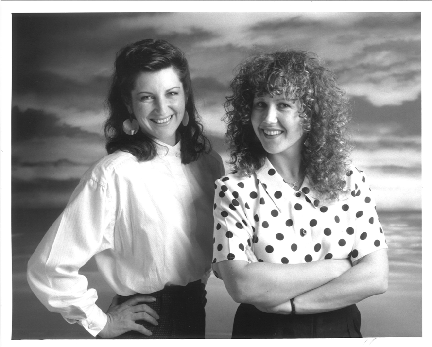
Deborah and Melinda, 1990
When I announced to Deb that I wanted to create a new Melbourne Map we discussed the project over some time, to work out the production challenges and Deborah’s capacity to commit to this huge project given her current life commitments.
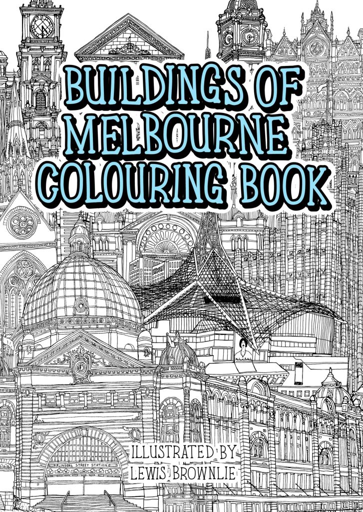
I had also entered into discussions with Lewis Brownlie whom I had met after discovering a Melbourne Buildings colouring book he produced back in 2015.
We all met and worked out the best solution for The Melbourne Map which was for Lewis to take on the role of chief illustrator and draw the lions share of the map including roads, buildings and gardens etc.
How did Lewis Brownlie become involved in the current Melbourne Map project?
I met Lewis after discovering his work in a Colouring book of Melbourne. I contacted him because I thought he might like to see a copy of our first line drawing of Melbourne published back in 1990. As it turned out Lewis lived not far from me and we organised a meeting.
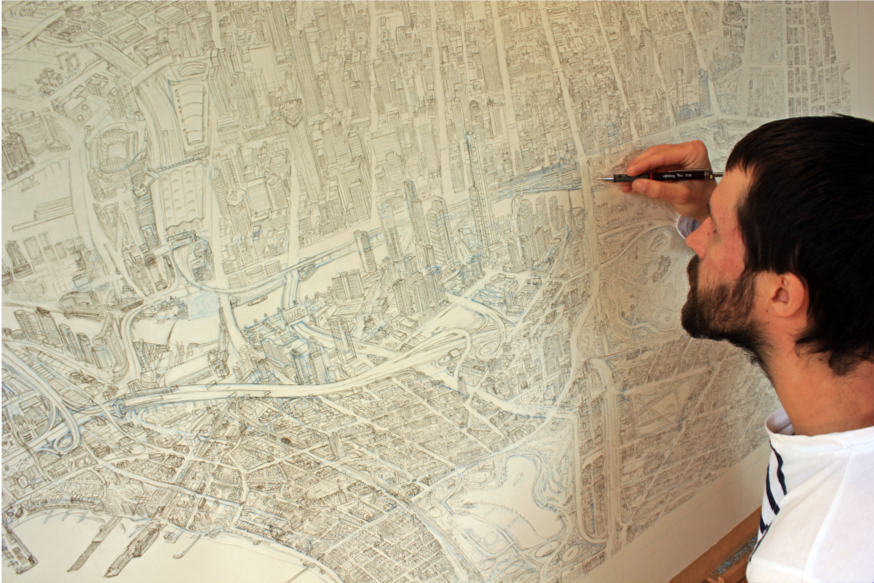
After several more meetings I invited him on to the project and he enthusiastically accepted. It has now taken up a big chunk of his life having worked on the illustration for nearly 18 months so far. It has certainly taken way longer than we both anticipated but it is such a fantastic project to be involved with and an important historical record of Melbourne, at this point in time.
It is a map that will be referred to for centuries, just like we pour over old maps of cities drawn in the 15th-21st centuries. I always tell purchasers of the limited editions that this will be the artwork their great grandchildren will be wanting to have.
Why are you so passionate about maps?
The visual appeal of an illustrated map, the details, the stories, the endeavour to create them.
Initially I was in my own ‘map bubble’ creating the first Melbourne illustration, having no idea how to go about completing such a project, no rules to follow and no map making experience nor background in cartography.
It became very evident after we published the first illustration, just how much this artwork meant to people who lived in and visited this beautiful city. The sense of connection and achievement the map has given me has shaped my life.
I’m over the moon to have taken the leap 28 years later to publish The Melbourne Map 2.0 I hope it inspires a new generation of illustrated map makers to invest in documenting their cities.
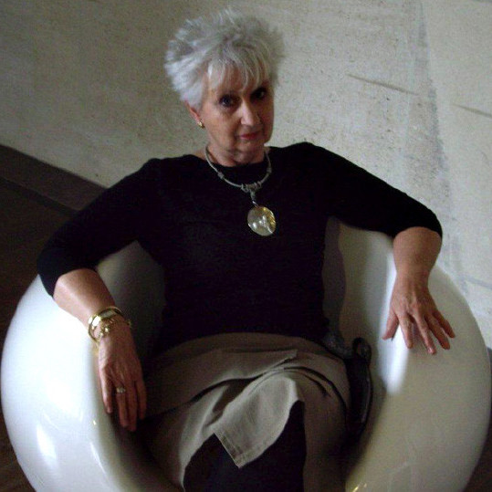
Deborah Young
Discuss the comparisons between your involvement in the first and current Melbourne Map.
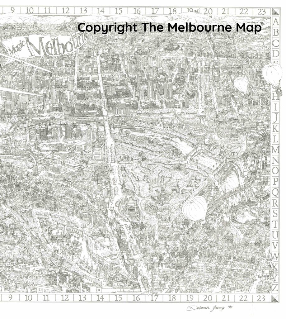
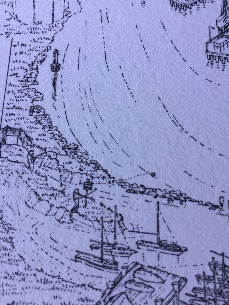
The first Map published in 1991 was originally drawn by me including the design, streets, the text and buildings and character illustration such as people, boats, planes etc.
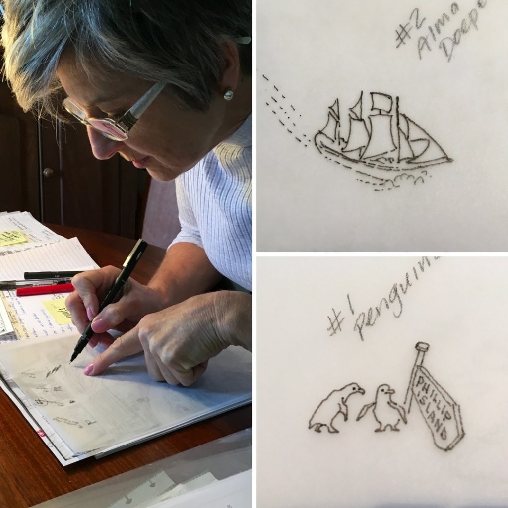
This time the 2018 updated Map of Melbourne’s streetscape and layout are being drawn up by Lewis Brownlie whereas I am drawing street names and character illustrations. This includes the Chinese dragon, the Phillip Island Penguins, balloons, planes etc. and people on the streets.
1990 Melbourne Map, Pen and Ink.
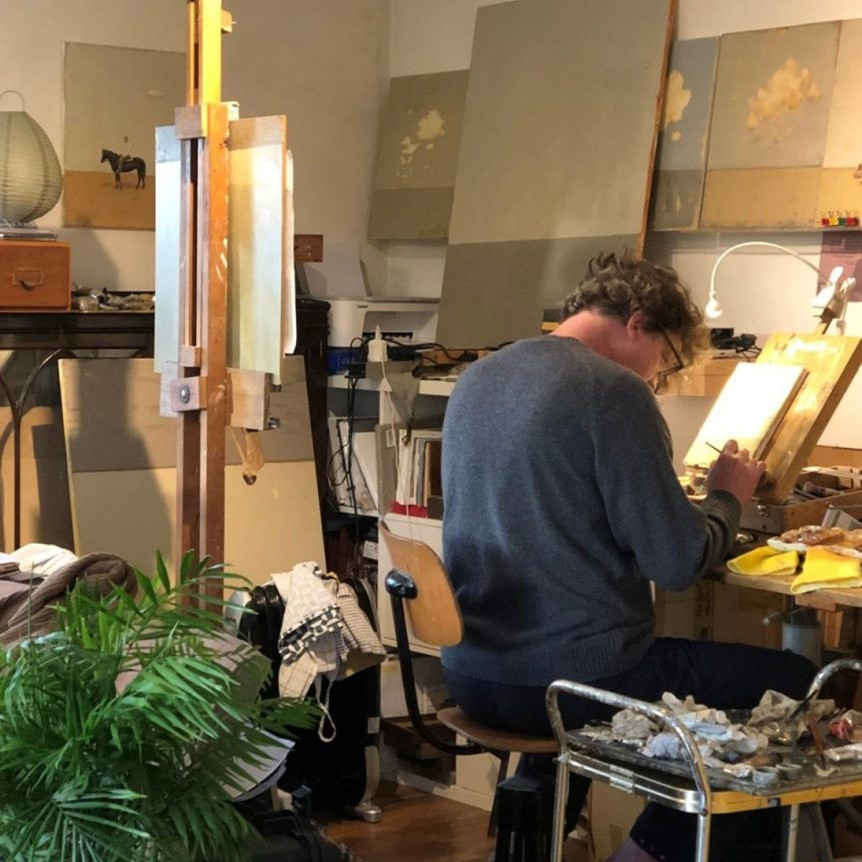
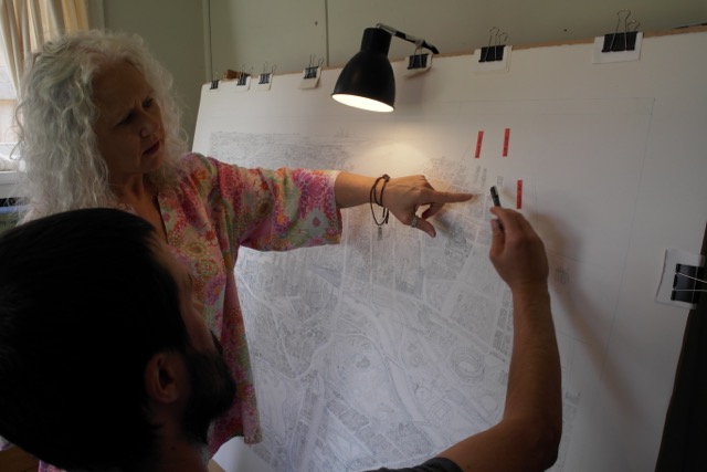
You are currently working on the human, animal and transport illustrations. Can you take one or two and discuss the actual drawing and where and how they fit onto the map?
Each day Melinda sends me requests for new additions to include in the drawings; such as the people who have paid to be individually represented, sometimes by their car, their favourite location or as with Frazier Film production unit, their distinctive trucks which will be shown on Dandenong Rd.
These are drawn using photographs the owners have taken; otherwise the images are those we’ve all agreed need to be recorded from our travels, such as the Portarlington Ferry where the boat is photographed and located on the drawing where it is usually housed.

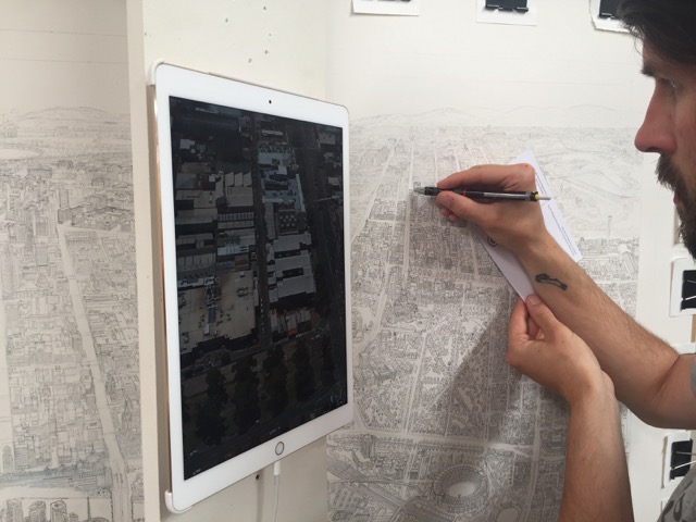
Explain the technique you use to put these drawings onto the map from the early stages to the final placement.
It would be a logistic nightmare for both Lewis and I to draw onto the Map at the same time – and because of the wonders of modern technology available to us, I am drawing and recording every character separately using a rotring graphic 0.2 pen onto tracing paper which are placed over carefully scaled and photocopied sections of the drawing. These images will be digitally scanned into the completed scanned image of the finished original drawing ready for print.
Why do you feel the map needs to have these animations?
Originally on the ‘91 Map I wanted to give life and personality to the drawing and the many characters illustrated turned out to have enormous appeal. It became fun to record the many incidental and distinctive scenes and characters and landmarks in our travels.
One such example was the fellow shown practising golf (blissfully ignorant of the “No Golf” sign beside him) in Williamstown. We’ve always wondered if he ever realised that he was “sprung” and immortalised in our work!
What makes your additions ‘so’ Melbourne?
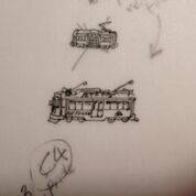
The characters within the drawings are actual and as such represent and characterise the City we love. Each city has a particular street culture typified by the style of the local public transport. We have our iconic trams and to a degree our trains to help codify chain themes.
Our quirky landmarks make the location easy to recognised such as the giant flag at the top of Elizabeth St in the north of the CBD, Little Audrey the Vinegar Skipping Girl in Richmond, or the Vietnamese Gateway on Victoria St Richmond. Others include the Ted Whitten sculpture (one of Melbourne’s particularly famous football sons) or, Puffing Billy, a generically Melbourne icon.
Other characters such as joggers, helicopters, balloons, rowers are more typical of all Australian cities but these elements in their recognised locations make it uniquely and especially Melbourne, seen by locals every day and looked for by visitors.
When locals see their city drawn in loving detail, it gives it a certain credibility and credence in their mind’s eye.
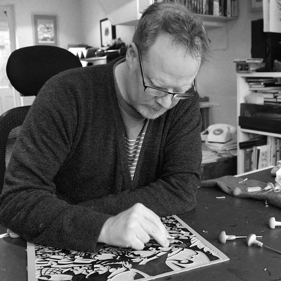
Lewis Brownlie
What is your art background?
I studied Fine Art at Rochdale College, then at John Moores University, Liverpool. My first art related job was as a gallery technician at Bolton Museum, in Lancashire. I was also experimenting in different art mediums, hosting and exhibiting in exhibitions with fellow artists, often doing illustration jobs for skateboard companies in England.
About 5 years ago I went travelling through South East Asia drawing from life every day for about four months, drawing inspiration from the surrounding architecture, landscape, people and things that go on (from climbing mountains sitting in buses for hours). This took me through Thailand, Vietnam, Cambodia, Malaysia and Bali, before landing in Sydney and travelling down to Melbourne via train to visit friends. In Australia I continued my tradition of continually drawing my surroundings, wanted to send some bits home to family and friends. So I made postcards from my drawings. I was inspired to start art busking in the town centre of Melbourne, whilst working away on drawings, I would sell prints at the same time. It was a “win’, win”. This led on to my ‘Buildings of Melbourne’ Colouring book and consequently to meeting Melinda and finding out about The Melbourne Map project.
Can you expand on your original time estimate and how long the project is take you to illustrate?
When I first met Mel and discussed the project I thought that we could achieve the completed line drawing within at least 6 months. I have now been working for about 18 months and probably have another 8 to go. (3 months on ink, 1 on digital production and 4 on colouring) The project is way more detailed than we both anticipated and we made some artistic decisions along the way to expand the parameter of the map and do a major re-draw of some sections.
Take 2 or 3 buildings or areas you have had a strong bond to and why?
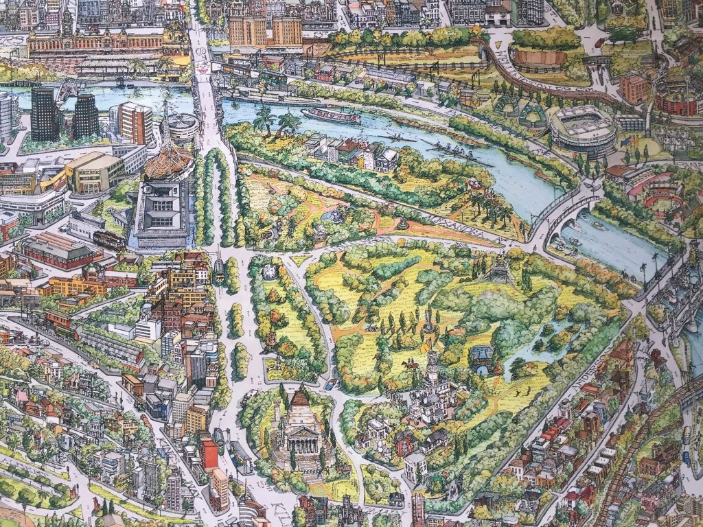
I worked on a small book for the City of Melbourne about the Fitzroy Gardens. It was really great to re-visit this area of the Melbourne Map and create more detail in the drawing.
Flinders Street Station was the first building I drew when I arrived in Melbourne, I was sat on the steps of the young and Jackson pub waiting for a friend. The copper dome is very impressive, that and Federation square are the central point of Melbourne on our map and most likely will be the first thing people’s eyes move towards.
Discuss the frustrations of building and planning in Melbourne and illustrating a map?
It’s cat and mouse, on the ever, evolving city scape. There are currently 165 cranes on Melbourne’s skyline and in terms of research it is a bit of a logistical nightmare keeping up with the construction, what a building is going to look like when it is finished and whether it will be included on this version.
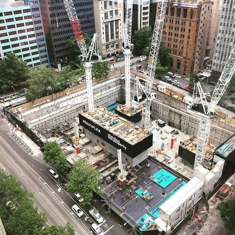
Cranes of Melbourne
This is the first map I have attempted on this scale so there is a lot of learning along the way. We are anxious to complete the project as soon as possible but at the same time take the time to be accurate and true to Melbourne’s essence and character.
Explain the importance of the actual dimensions in this work?
The original size of the illustration is 1.5 x 1m. Sometimes I wish I was working on a piece of paper double this size so we could fit in even more detail.
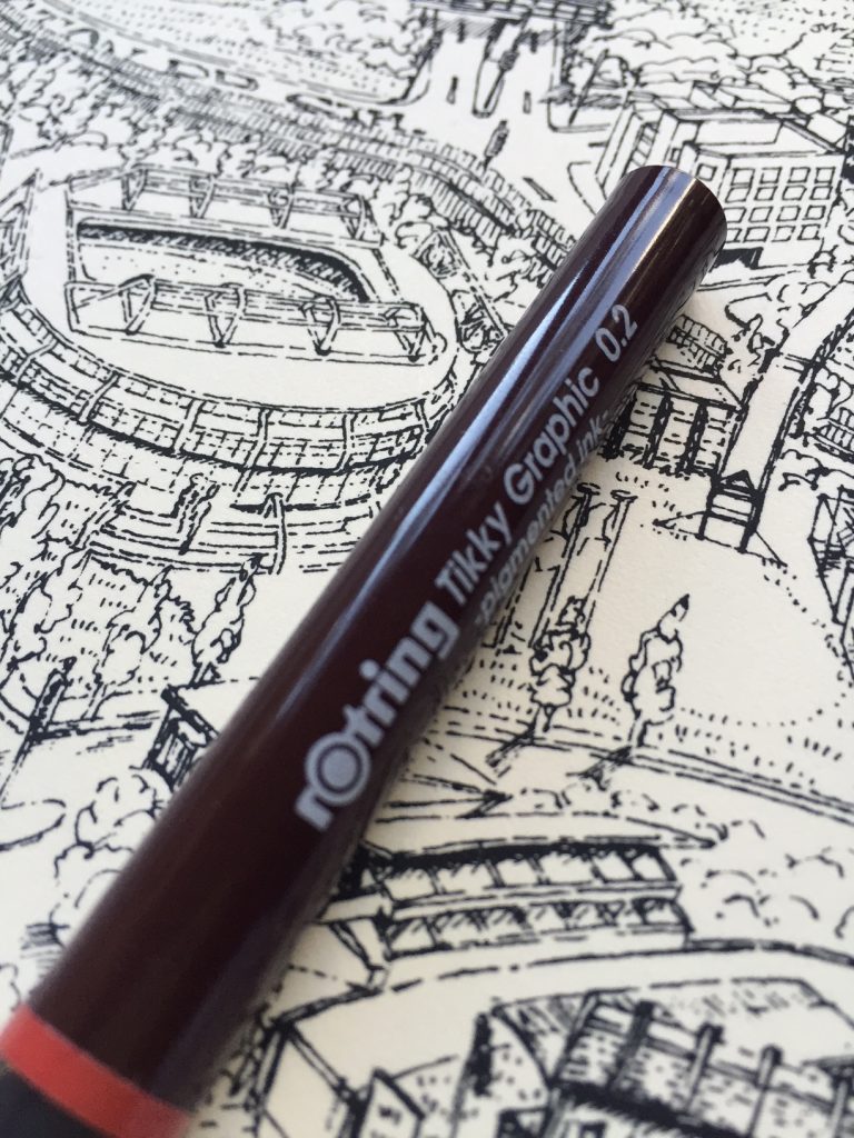
There is significant detail in each of the major landmarks and buildings which I am able to capture with a 0.05 Uni Pin. Mitsubishi Pencil Company who make the Uni pin heard about our project and sent us 4 boxes of the pens – we will probably use every one of them on this drawing.
What are some of your favourite buildings; and why?
Modern
I love the Arts Centre, the many triangles of the spire was great to draw.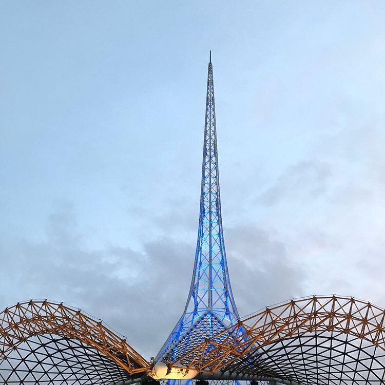
Old
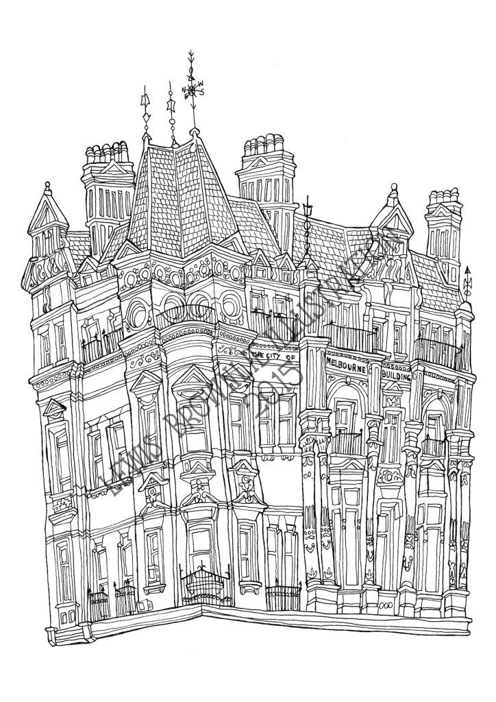
Manchester Unity building is a grand old lady, I love the inside and outside of this iconic and grand representation of old Melbourne.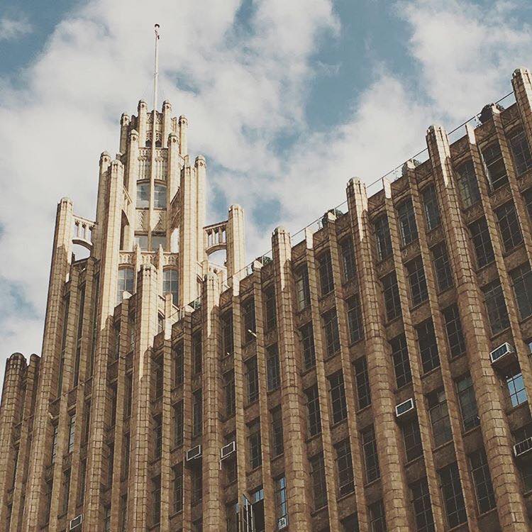
Beautiful
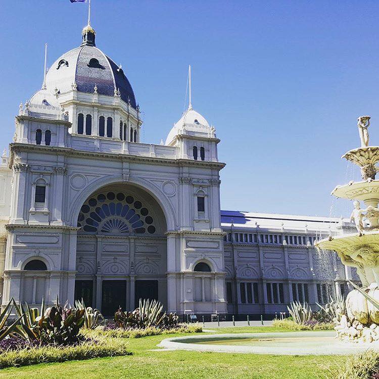
The Exhibition Building is so grand, steeped in Melbourne’s history and a pleasure to walk in and around each and every time.
Tired
The City of Melbourne Building on Elizabeth Street is looking very tired. Corner of Elizabeth & Little Collins. Hopefully someone will give it some love soon but keep it’s beautiful original charm (i.e. no skyscraper coming out of the middle of it!)
How has your relationship to Melbourne changed since you began on this project?
All
Discuss your thoughts of working on a long-term, team project
Melinda
Having lived through a few long term projects, I had an understanding this time of what it would take to produce the map. I love the interaction and collaboration with the team and I thrive on the challenges that the project brings. There are so many elements to bringing this map to life, so much more than anyone could realise.
The pressure of funding the project is not the fun part however pre-sales on our website and crowd funding has been a whole new experience for me and I love that we can share the progress of the artwork via social media.
With the first Melbourne map (started 30 years ago) we only really had a handful of people visit the garage throughout production and had to wait 4-5 years before knowing if it would be liked or not.
As we journey through each stage of the project we connect with the most amazing people, some who are familiar with the first map, others who have discovered the project for the first time. The encouragement and support has been so rewarding and I can’t wait to deliver the map to its new homes here and abroad… Melinda
Deborah
From my point of view, the Melbourne Map team is a wonderful balance of skills and professionalism. We all want to achieve the same end product, with the same standard and all realise what it takes for every element to come together. It’s rigorous and because we want the outcome we are careful to discuss any issues and resolve them. Previous experience has meant that we all know how it feels if you don’t recognise and make changes in-order to have it perfect for print. We are all on the same page…..no pun intended… Deborah
Lewis
It’s taken a lot longer than I expected that’s for sure. It was strange to get into the rhythm and understand the scale of the project. Especially early on, in the pencil stages. With never endeavouring on such a project it was really hard to predict any timeframe, not fully knowing or understanding the level of detail and attention required to research and create the large artwork.
The background knowledge and knowing the city and suburbs inside and out is a big job in itself, and coming from England, I’ve only had the pleasure of knowing Melbourne for the past four years. I’ve had to learn a lot quite quickly. I feel it’s a huge responsibility to all the people who live and work in the city, they all have their own areas and need representing. Knowing what buildings, streets and parks are significant is very helpful when people get in touch to let us know about certain community events or regular markets, these nuances can all go into the map and bring it to life. The more information we can have the better.
I spend most of my days drawing the map, and other days researching, its changed my view and appreciation of the city. I spend more time drawing the map and looking at images on the computer screen than I do in the real city. Which is quite weird. Sometimes when I go to the city, because I have this image (the map) burned into my mind, I get confused as to which is the real one.
When we see cranes or learn about building works happening in the city, that causes a bit of annoyance, knowing that somethings changed and needs altering in the map. There’s always something changing, and the longer the drawing takes, the more the city changes, so that’s another reason why I need to keep up a good pace.
It’s great to have each other, Mel and Deborah are brilliant encouragers and critiques, and we bounce ideas around and solve problems and issues together (what’s going where, in terms of characters and vehicles) collaborating like this is a really fun part.
But in the meantime, I must go back to the drawing board… Lewis
![]()
Contact details:
The Melbourne Map
Website and discounted pre-sales: www.themelbournemap.com.au
Email: melinda@themelbournemap.com.au
Melinda Clarke, Deborah Young, Lewis Brownlie, Melbourne, Australia
Interview by Deborah Blakeley, March 2018
Think a colleague or friend could benefit from this interview?
Knowledge is one of the biggest assets in any business. So why not forward this on to your friends and colleagues so they too can start taking advantage of the insightful information the artist has given?
Other artists you may be interested in: